

Typhoon Dolphin Forecast Track: Will It Reach South Korea? August 7 Position and the Shift from Heat Waves to Heavy Rain
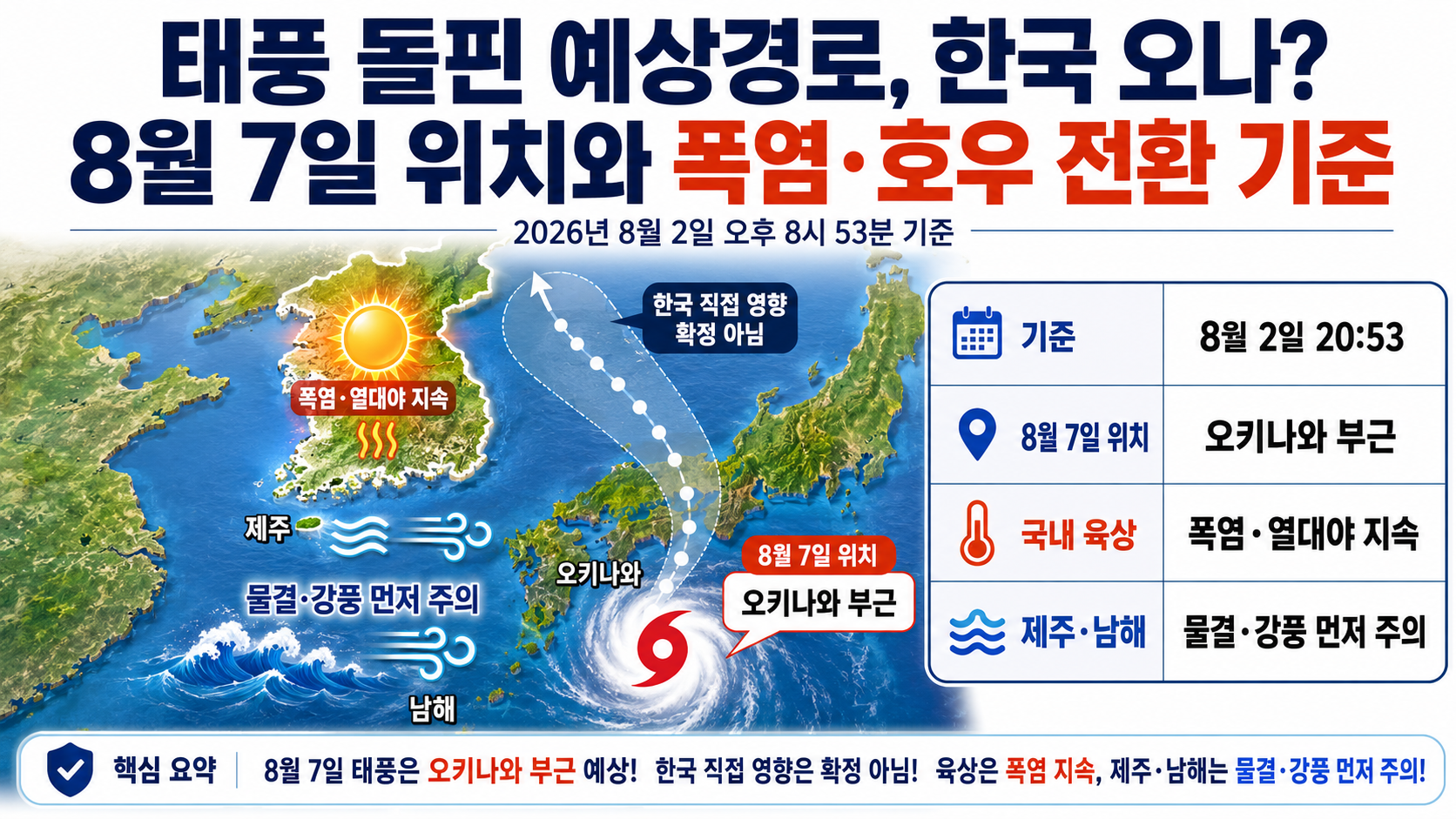
As of 2026-08-02 at 8:53 p.m., it is too early to conclude that Typhoon Dolphin will reach South Korea. The Korea Meteorological Administration's current forecast places the typhoon's center near Okinawa, Japan, on August 7, while heat waves and tropical nights are expected to continue across South Korea for the time being.
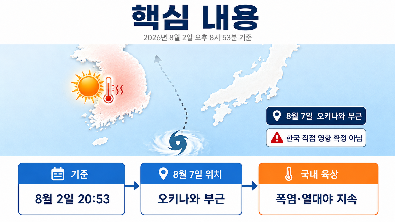
However, high waves and strong winds may pose risks around Jeju Island and the South Sea before significant impacts are felt on land. It is important to monitor whether the forecast track shifts northward and whether rain begins appearing in South Korea's domestic forecasts.
Where Is Typhoon Dolphin Now?
According to information released by the Korea Meteorological Administration at 4 p.m. on August 2, Typhoon Dolphin, designated Typhoon No. 13, was moving west-northwest over the open ocean northeast of Guam at 3 p.m. that day.
| Category | Current or Forecast Position | Central Pressure | Maximum Wind Speed | Direction of Movement |
|---|---|---|---|---|
| August 2 15:00 | 23.2°N, 152.3°E | 930hPa | 50m/s, 180km/h | West-northwest |
| August 4 15:00 | 25.1°N, 142.0°E | 940hPa | 47m/s, 169km/h | West |
| August 6 15:00 | 26.1°N, 131.9°E | 945hPa | 45m/s, 162km/h | West |
| August 7 15:00 | 26.8°N, 127.8°E | 950hPa | 43m/s, 155km/h | West-northwest |
The forecast position for August 7, at 26.8°N and 127.8°E, is near Okinawa, Japan. The currently published forecast track does not show the typhoon's center moving over Jeju Island or the Korean Peninsula.
Therefore, it would be incorrect at this stage to claim that landfall in South Korea is confirmed or that typhoon impacts across the entire country are certain. The accurate assessment is that direct impacts on South Korea remain uncertain, while a westward track toward the Okinawa area is currently the more likely scenario.
Does a Larger 70% Probability Radius Mean the Typhoon Will Reach South Korea?
The 70% probability radius does not represent the size of the typhoon. It indicates a circular area within which the typhoon's center may be located at the forecast time.
The 70% probability radius for the forecast position on August 7 is 440km. A larger radius means greater uncertainty about the center's location farther into the forecast period. It does not mean that every location within 440km will experience the same level of typhoon damage.
There are three separate elements to examine on a typhoon map.
| Map Feature | What It Actually Means |
|---|---|
| Forecast center track | A line connecting the predicted center positions at successive forecast times |
| 70% probability radius | The range of uncertainty in the forecast position of the typhoon's center |
| Strong-wind radius | The area around the center where winds of at least 15m/s are expected |
A forecast line that does not point toward Jeju Island does not mean there will be no impacts at all. Likewise, part of the probability radius moving closer to South Korea does not confirm landfall. The center position should be assessed together with the strong-wind radius, marine forecasts, and domestic precipitation forecasts.
Is the Typhoon Weakening?
According to the Korea Meteorological Administration's forecast, Dolphin is expected to weaken slightly as it approaches Okinawa, although its maximum wind speed will remain strong.
Author's calculations
Maximum wind speed: A decrease of 7m/s, from 50m/s to 43m/s
Percentage decrease: `(50-43)÷50×100 = 14%`
Central pressure: An increase of 20hPa, from 930hPa to 950hPa
Rising central pressure and declining maximum wind speed indicate weakening. However, because the maximum wind speed is still forecast to reach 43m/s on August 7, weakening should not be interpreted as meaning the typhoon is safe.
When forecasts are updated, check how central pressure and maximum wind speed change alongside the predicted position.
Continued Heat Is Currently More Likely Than Heavy Rain
The Korea Meteorological Administration's medium-range forecast issued at 6 p.m. on August 2 predicted generally clear skies nationwide during the forecast period, with morning temperatures of 24~27°C and daytime temperatures of 32~38°C.
Maximum apparent temperatures are expected to reach at least 33°C across most of the country and 35°C or higher mainly in inland areas. Heat waves and tropical nights are therefore likely to continue. Based on the current forecast alone, there is no indication that nationwide weather conditions will immediately shift to a prolonged period of heavy rainfall.
Even temporary rain or showers do not necessarily mean the heat wave has ended. If temperatures rise again while humidity remains high after the rain stops, apparent temperatures can increase rapidly.
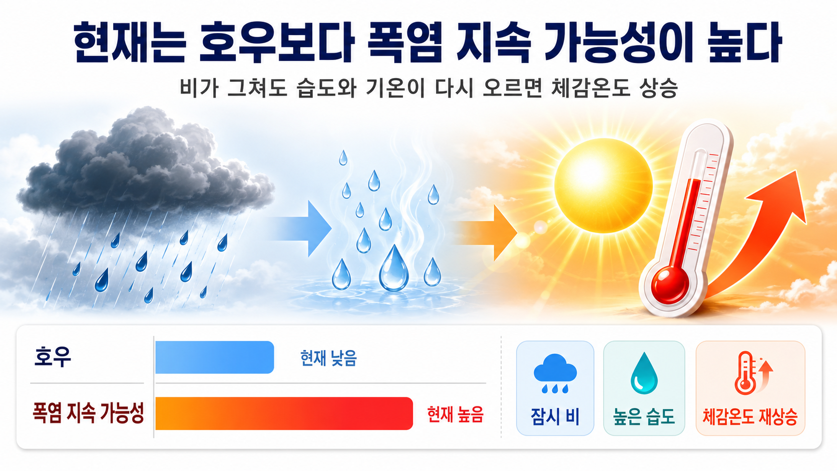
In particular, if the typhoon moves westward south of the Korean Peninsula and creates a weather pattern that pushes hot air northward, the heat wave in South Korea could last even longer. This is one possible track scenario, not a confirmed outcome.
Is There an Official Threshold for a Shift from Heat Waves to Heavy Rain?
There is no single official numerical threshold that determines the exact moment when a heat wave changes into heavy rain. The cancellation of a heat wave advisory does not mean heavy rain will immediately begin, and the issuance of a heavy rain warning does not mean heat waves will end simultaneously across the country.
In practice, several indicators should be monitored together.
1. Whether the Forecast Typhoon Position Shifts Northward
Check whether the forecast center for August 7 continues moving northward from the Okinawa area toward waters south of Jeju Island or the northern East China Sea.
Rather than relying on a single forecast from a private weather model, it is more important to monitor consecutive changes in the center position and 70% probability radius in official typhoon bulletins issued by the Korea Meteorological Administration.
2. Whether Rain and Precipitation Amounts Appear in Domestic Land Forecasts
The current medium-range forecast indicates generally clear weather nationwide. If rain is subsequently added to the forecast, beginning with Jeju Island and southern regions, and specific precipitation amounts are provided, the possibility of a weather pattern change will have increased.
Do not look only at the probability of precipitation. Also check expected rainfall totals, hourly rainfall intensity, and the periods when rain is expected to be most concentrated.
3. Whether Preliminary Heavy Rain Advisories or Heavy Rain Warnings Are Issued
| Category | Issuance Criteria |
|---|---|
| Heavy rain advisory | At least 60mm expected within 3 hours, or at least 110mm within 12 hours |
| Heavy rain warning | At least 90mm expected within 3 hours, or at least 180mm within 12 hours |
These thresholds are not criteria for ending a heat wave. They are warning thresholds used to assess the level of heavy rainfall risk. If a preliminary heavy rain advisory is issued for your area, first inspect drainage outlets, underground spaces, riverbanks, and roads vulnerable to flooding.
4. Whether Marine Warnings Around Jeju and the South Sea Are Strengthened First
The Korea Meteorological Administration forecast that waves would reach 2~5m in the South Sea and waters around Jeju Island from August 7 through 9.
Even if the typhoon's center passes far from South Korea's land areas, high waves, swells, and strong winds may affect offshore waters and coastal areas first. Anyone planning a trip to Jeju, ferry travel, fishing, or a beach visit should check ferry operating information and marine weather warnings again immediately before departure.
How Could South Korea's Weather Change Depending on the Typhoon's Track?
| Track Scenario | Possible Changes in South Korea |
|---|---|
| Moves westward past the Okinawa area, as currently forecast | Heat waves and tropical nights may continue nationwide, while waves could become higher first around Jeju Island and the South Sea |
| Moves farther north than expected | Rain and strong winds may become more likely, starting in Jeju and southern regions, while heat could ease in some areas |
| Moves farther west toward China | Direct impacts on South Korea may decrease, but an inflow of hot air could prolong the heat wave |
| Turns toward the south or east of Japan | Impacts on South Korea may diminish, although the duration of the heat wave could vary depending on the position of surrounding high-pressure systems |
This table presents scenarios based on possible atmospheric pressure patterns. The actual outcome should be assessed by monitoring subsequent changes in the Korea Meteorological Administration's forecast track and domestic short-range forecasts.
Heat Wave Precautions Should Be the Immediate Priority
Heat is currently the primary weather risk requiring attention in South Korea. Do not stop taking heat precautions simply because of rumors that a typhoon is approaching.
Avoid outdoor activities and agricultural work during the hottest hours of the day.

Drink water frequently instead of relying on alcohol or caffeinated beverages.
Check that infants, young children, older adults, and people with chronic illnesses have adequate cooling.
Do not leave people, pets, or flammable materials inside vehicles.
Travelers heading to Jeju or the South Sea should recheck ferry services and marine forecasts for August 7–9.
Do not decide to cancel travel plans or close facilities based on a single image from a private weather model.
When Should You Check the Next Forecast Track?
The nearest scheduled official update is the Korea Meteorological Administration's typhoon information bulletin at 10 p.m. on August 2.
Rather than drawing conclusions from a slight change in a single update, it is better to compare the following indicators across successive forecasts.
1. Whether the latitude of the forecast center for August 7 has increased
2. Whether the direction of movement changes from west to west-northwest or northwest
3. Whether preliminary strong-wind or high-seas advisories are issued for Jeju Island and the South Sea
4. Whether rain is newly added to South Korea's medium-range forecast
5. Whether central pressure and maximum wind speed indicate a stronger typhoon than previously expected
Frequently Asked Questions
Will Typhoon Dolphin Make Landfall in South Korea?
The Korea Meteorological Administration's current official forecast track does not indicate landfall in South Korea. The center is expected to be near Okinawa on August 7, but subsequent official updates must be checked to determine its later track.
Will the Heat Wave End Immediately if the Typhoon Approaches?
If the typhoon approaches the Korean Peninsula and brings widespread rain clouds, temperatures may fall. Conversely, if the typhoon moves toward China and draws hot air northward, the heat wave could last longer.
Will a Heat Wave Advisory Be Lifted if Showers Occur?
Even if showers temporarily lower temperatures, hot conditions may return if humidity remains high after the rain stops. Heat wave advisories are issued or lifted separately based on forecasts of the daily maximum apparent temperature.
Is It Dangerous if the Forecast Track's Circle Moves Closer to Jeju Island?

The 70% probability radius represents the range of possible positions of the typhoon's center. To assess the typhoon's actual impacts, consider not only the center position but also the strong-wind radius, expected precipitation, and marine weather warnings.
The current conclusion is clear. Typhoon Dolphin's movement toward South Korea has not been confirmed, and heat waves and tropical nights are expected to remain the dominant conditions over the country's land areas for the time being. However, the possibility of high waves around Jeju and the South Sea on August 7–9, as well as any northward revision to the typhoon's forecast track, should continue to be monitored.