

Typhoon Nangka (No. 17) Confirmed: Why Its Track Matters More Than Its Formation When Assessing the Impact on South Korea
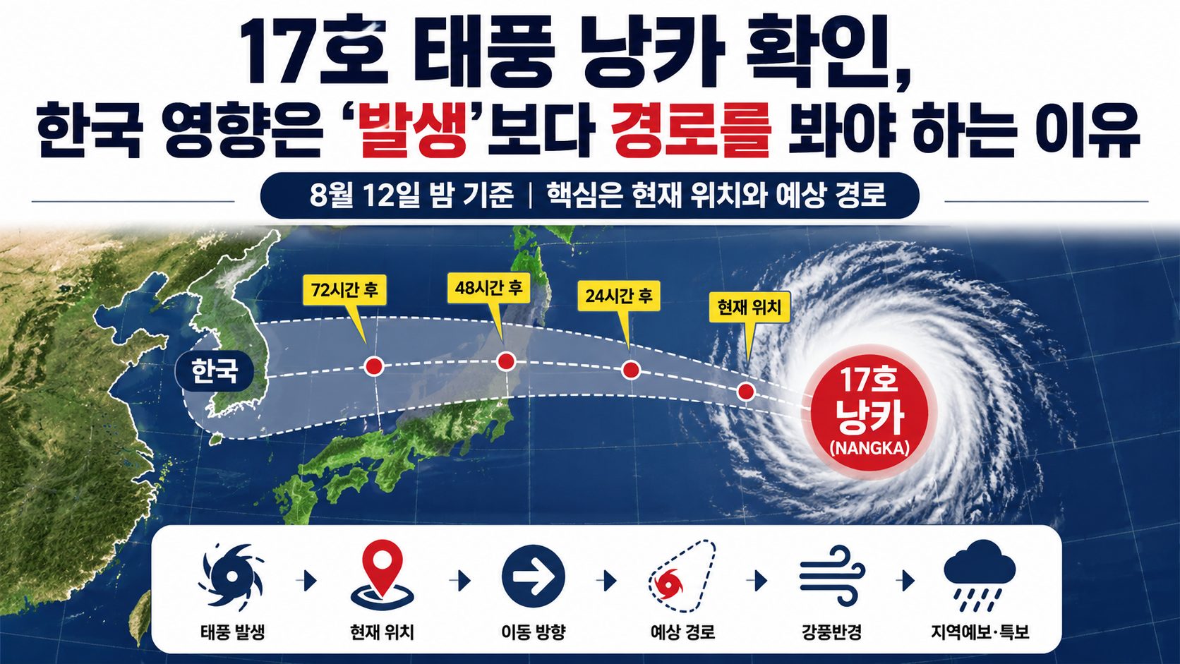
The 17th typhoon of 2026 is Nangka (NANGKA). As of the night of August 12, the most important thing to check is not simply the fact that Typhoon No. 17 has formed, but its current location, direction of movement, and how close its forecast track may bring it to the Korean Peninsula.
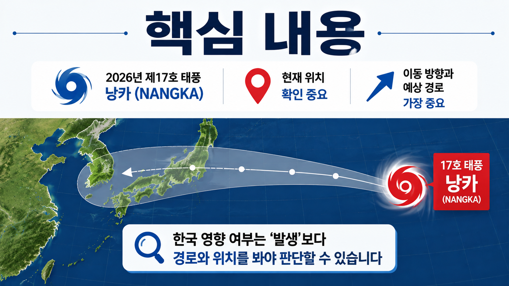
Not every typhoon affects South Korea simply because it has formed. In particular, forecast positions several days ahead can continue to change, so it is important to avoid treating specific predictions such as 'landfall in South Korea' or 'a direct hit on Seoul' as confirmed too early.
The 17th Typhoon of 2026 Is Named Nangka
The official name of Typhoon No. 17 is Nangka (NANGKA). Nangka is a name submitted by Malaysia and refers to a type of tropical fruit.

The designation 'No. 17' does not indicate a typhoon's strength ranking. It is a number assigned according to the order in which typhoons form during 2026. Therefore, the number 17 does not mean that this typhoon is stronger than earlier storms or poses a greater danger to South Korea.
When monitoring a typhoon, it is important to check its central pressure, maximum wind speed, radius of strong winds, direction and speed of movement, and forecast track rather than focusing only on its number.
It is also important to remember that older records involving 'Nangka' may appear in search results. Because typhoon names can be reused under an established naming system, mixing up the dates and tracks of previous storms named Nangka with those of Typhoon No. 17 in 2026 could lead to an incorrect assessment of the current situation.
The Appearance of Typhoon No. 17 on a Map Does Not Confirm an Impact on South Korea
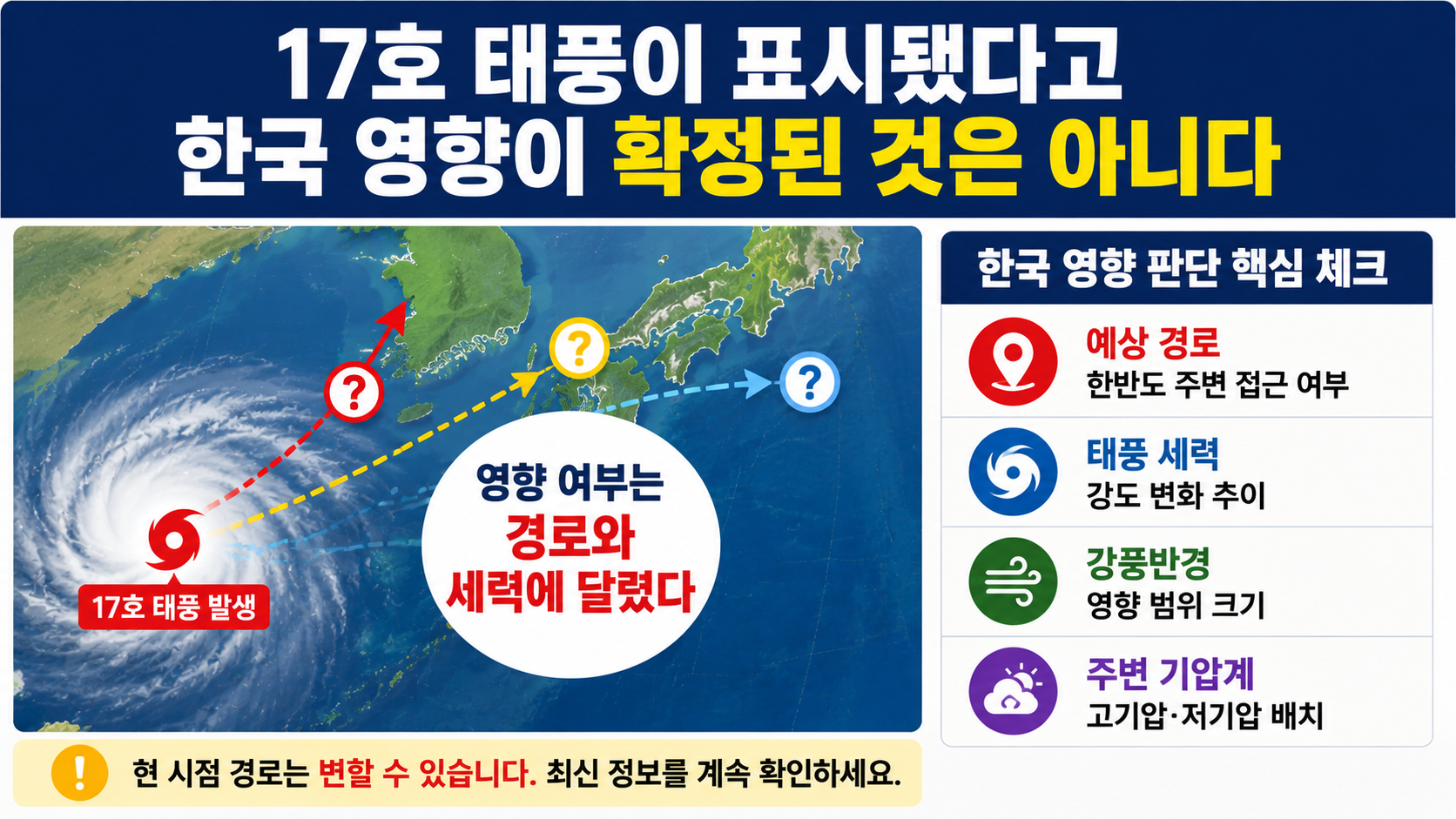
The formation of a typhoon and whether it will affect South Korea are two different pieces of information. To determine whether South Korea may be affected, it is necessary to examine whether the forecast track approaches the Korean Peninsula, along with the storm's strength, radius of strong winds, and surrounding atmospheric pressure systems.
If you have only seen the typhoon's name in search results or a screenshot, it is worth checking further. A typhoon information page may continue to display a storm or tropical depression for some time even after updates on that system have ended.
Therefore, it is incorrect to connect three separate assumptions into a single conclusion: 'Typhoon Nangka (No. 17) is listed → it is currently active → it is heading toward South Korea.'
To check the current situation accurately, follow this order:
Latest typhoon bulletin time → Current location → Direction and speed of movement → Forecast positions at 24, 48, and 72 hours → Radius of strong winds → Domestic weather advisories and local forecasts
Even if a typhoon's center does not make landfall on the Korean Peninsula, the country may still be affected by its strong-wind radius, moisture inflow, or surrounding pressure systems. Conversely, even if a typhoon forms in the northwestern Pacific, the likelihood of a direct impact decreases if its track moves farther away from South Korea.
The First Things to Check on a Forecast Track Are the Date and Location
When looking at a typhoon track map, do not focus only on the shape of the line. Check the date and time represented by each forecast position. Even on the same track map, a forecast for 24 hours ahead carries a different degree of uncertainty from one covering several days ahead.
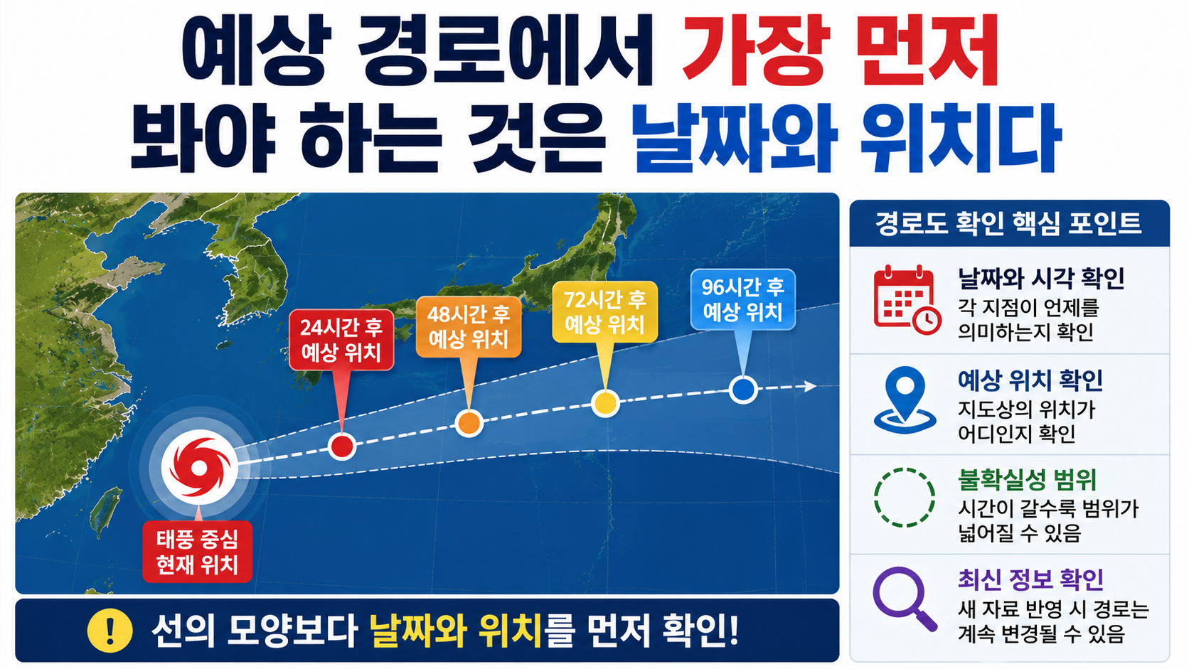
The area shown around a forecast position should not be interpreted as the physical size of the typhoon. The farther into the future a forecast extends, the wider the area in which the storm's center may actually be located can become.
For example, if one edge of a forecast track several days ahead points toward the Korean Peninsula, it would be inappropriate to treat that point as the storm's confirmed path. As new observational data becomes available and the positions of surrounding high-pressure systems and troughs change, the forecast track may also change in the next bulletin.
If you need to make decisions about travel or outdoor activities, it is more reasonable to check the latest updates again as your departure date approaches rather than deciding whether to cancel based on a single long-range forecast.
To Assess Whether the Typhoon Will Reach South Korea, Track Changes Matter More Than Intensity
When trying to determine whether South Korea will be affected, it is more important to first examine how the typhoon's direction of movement is changing than to focus solely on its maximum intensity.
Even a powerful typhoon may have only a limited impact on South Korea if it moves far away from the country. Conversely, even as a typhoon weakens, high waves and strong winds may still occur if it approaches nearby waters or areas around the East Sea or South Sea.
It is also impossible to calculate the potential damage in a particular area based only on the storm's central pressure in hPa. Actual impacts depend on the distance from the typhoon's center, its radius of strong winds, movement speed, terrain, moisture inflow, and interactions with other pressure systems.
Therefore, when checking information about Typhoon No. 17, it is more practical to compare successive bulletins to see whether its forecast track is moving closer to or farther away from South Korea than to focus only on whether the storm is classified as strong or weak.
'Landfall in South Korea' and 'Impact on South Korea' Are Not the Same Thing
It is important to distinguish between a typhoon's center making landfall and the country experiencing the effects of the storm.
Even if the center does not make landfall in South Korea, rain, strong winds, and high waves may occur if the storm's strong-wind radius extends over nearby waters or if moisture pushed northward by the typhoon interacts with other weather systems. Coastal and island regions may also experience different levels of impact from inland areas.
Conversely, even if a forecast track appears relatively close to the Korean Peninsula on a map, the actual impact may be different if the storm has a small radius of strong winds, limited strength, and is weakening rapidly.
Therefore, when checking whether Typhoon Nangka (No. 17) may affect South Korea in the coming days, it is necessary to look beyond the single question of whether it will make landfall and monitor changes in regional rainfall, wind, and marine forecasts.
When to Check Typhoon No. 17 Information Again
Typhoon information is not something to check once and then forget. As new observations are incorporated, the storm's location, intensity, movement speed, and forecast track may be revised.
In particular, when the forecast track approaches land areas in East Asia, including South Korea, Japan, or the East China Sea region, it is important to compare earlier track maps with the latest forecasts.
If you have travel plans, you should also check flight or ferry operating schedules separately from weather forecasts. Even if a typhoon does not make direct landfall in a particular area, flight and shipping schedules may change depending on weather conditions at airports and ports.
Coastal activities, fishing, camping, and hiking plans should likewise not be assessed solely on the location of the typhoon's center. If local weather advisories for rough seas, strong winds, or heavy rain have been issued, those advisories and safety guidance from the relevant authorities should take priority.
The situation surrounding Typhoon Nangka (No. 17) may continue to change. The key point to remember at this stage is simple: The existence of Typhoon No. 17 does not mean that an impact on South Korea has been confirmed. The latest forecast track and regional weather forecasts should guide practical decisions.
Whenever new typhoon information is released, start by comparing it with the previous forecast to see whether the projected track has shifted closer to or farther away from South Korea.