

Typhoon Dolphin Update: Moving South of Okinawa as Jeju Faces Strong Winds and High Waves
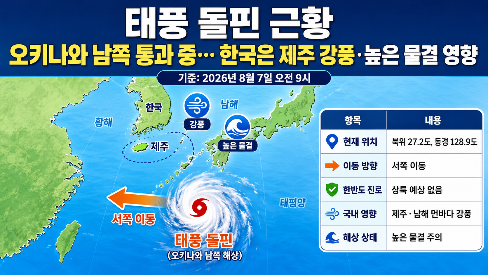
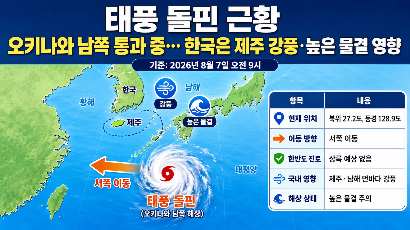
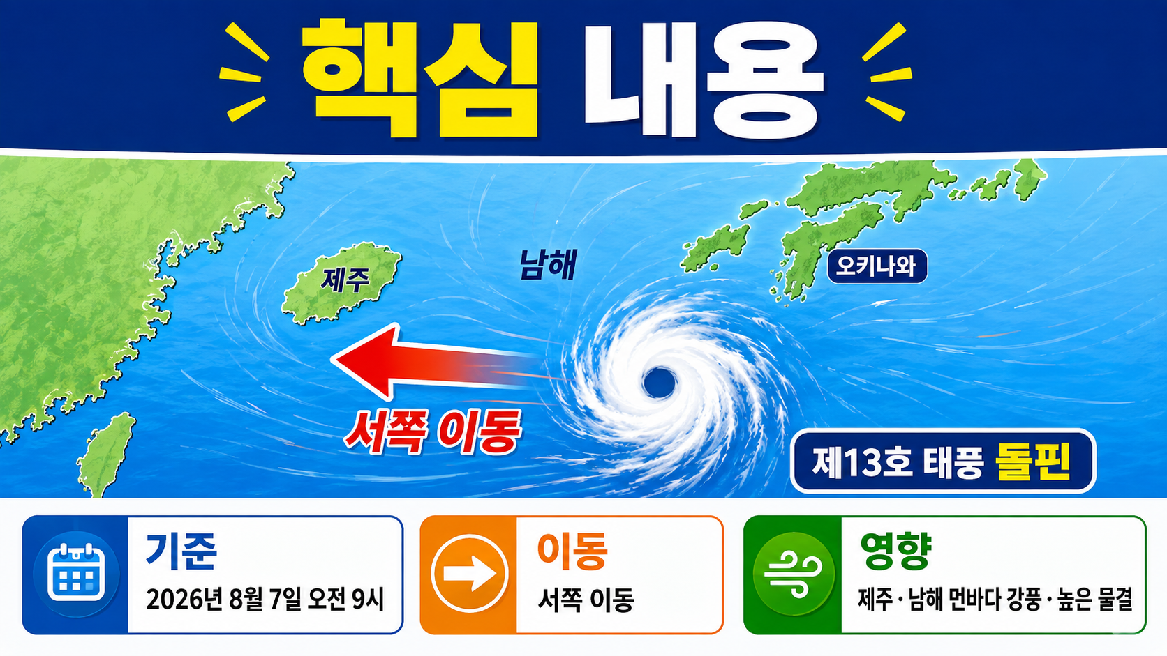
2026-08-07 As of 9 a.m., Typhoon Dolphin, the 13th typhoon, is moving westward over waters south of Okinawa, Japan. Its current forecast track does not include landfall on the Korean Peninsula, but Jeju and the offshore waters of the South Sea are already experiencing strong winds and high waves.
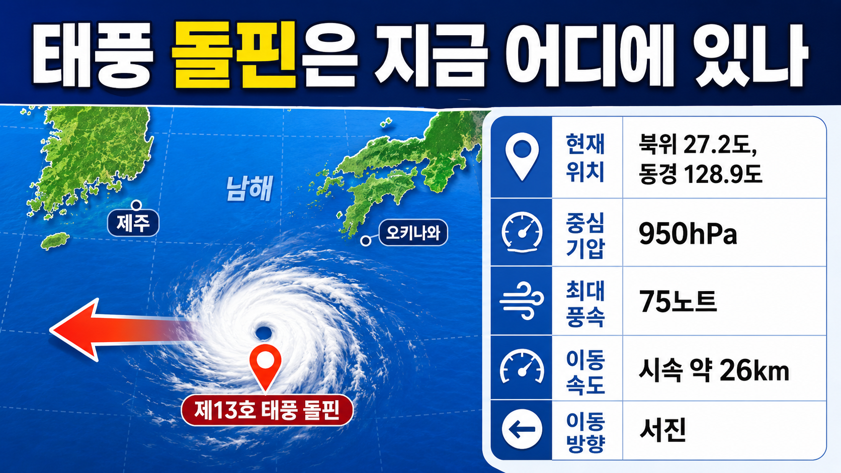
Where Is Typhoon Dolphin Now?
The center of Typhoon Dolphin is located at 27.2 degrees north latitude and 128.9 degrees east longitude. Its central atmospheric pressure is 950hPa, and its maximum sustained winds near the center are 75 knots. It is moving westward at approximately 26km/h.
Converting 75 knots into more commonly used units gives approximately 39m/s or 139km/h. Its movement speed of 14 knots is approximately 26km/h.
Author's calculations
Maximum wind speed: 75 knots × 1.852 = 138.9km/h
Movement speed: 14 knots × 1.852 = 25.9km/h
At its peak intensity, Dolphin's central atmospheric pressure dropped to 910hPa. Its current central pressure is 950hPa, which is 40hPa higher than at that time, indicating that the storm has weakened. Nevertheless, it remains a typhoon with extremely strong winds near its center.
Which Direction Will the Typhoon Move Next?
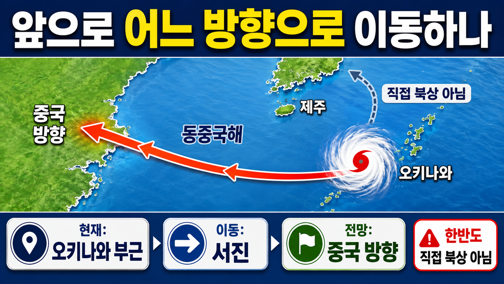
Dolphin is expected to pass near Okinawa, move westward into the East China Sea, and then head toward China. If it follows its current forecast track, it will not move directly north toward the Korean Peninsula.
The forecast center positions are near 27.0 degrees north latitude and 127.0 degrees east longitude at 9 p.m. on 7, and 26.9 degrees north latitude and 125.7 degrees east longitude at 9 a.m. on 8. On 9, it is expected to move toward the western East China Sea, then gradually weaken as it approaches inland China beginning on 10.
The typhoon's actual center may not follow the forecast track line exactly. The forecast cone represents an area with a 70% probability of containing the typhoon's center, so the potential impacts on Jeju or Okinawa should not be assessed based solely on the center line.
Focus on Impacts to Jeju and the South Sea Rather Than Landfall in Korea
The current official forecast track does not indicate landfall on the Korean Peninsula. However, because the typhoon's strong-wind area and swells extend over a wide region, dangerous marine conditions may persist around Jeju and the offshore waters of the South Sea regardless of whether the storm makes direct landfall.
According to an announcement issued at 10 a.m. on August 7, a strong wind advisory takes effect at 11 a.m. for Jeju's mountainous areas and its eastern, southern, western, and mid-mountain regions.
High wave warnings have been issued for the outer offshore waters south of Jeju and the outer offshore waters of the eastern South Sea, while high wave advisories have been issued for the coastal waters off eastern, southern, and western Jeju and the inner offshore waters south of the island.
Winds over the waters around Jeju and the outer offshore waters of the eastern South Sea may become extremely strong at 9~20m/s. Waves may reach 2~4m, exceeding 5m in some locations. On land in Jeju, instantaneous wind speeds may exceed 20m/s, with gusts potentially exceeding 25m/s in mountainous areas.
Even If Waves Look Small, Staying Away From Jeju's Coast Is Safer
Even when the typhoon's center is far from Jeju, long-period swells can reach the coastline. These swells can combine with other waves and suddenly wash over breakwaters or coastal rocks, making conditions dangerous even when the sea temporarily appears calm.
Along Jeju's coast, it is safer to postpone fishing from coastal rocks, walking on breakwaters, swimming, and other water activities. On coastal roads, waves may wash onto the roadway or seawater may flood low-lying areas, so visitors should check for local access restrictions before approaching.
Anyone planning to use a passenger ferry or fishing boat should confirm whether the vessel is operating before departure. Because cancellations or schedule changes may be finalized later than expected, it is advisable to check again immediately before traveling.
Is Checking Flight Status Enough for an Okinawa Trip?
Okinawa lies along the section of Dolphin's track where the typhoon is expected to pass closest. Travelers should therefore check not only their flights but also airport transfers, buses, monorail services, passenger ferries, and accommodation operations.
Even when a flight is listed as operating normally, strong winds may cause changes to departure or arrival times, or interrupt transportation to the airport. Travelers should continue checking departure airport operations, airline notifications, and announcements from local transportation operators until immediately before traveling.
At accommodations, it is advisable to move items near windows and belongings on balconies indoors. Anyone staying near the coast or in low-lying areas should also check evacuation instructions and identify the nearest indoor evacuation shelter.
Could Typhoon Dolphin Bring an End to the Heat Wave?
Dolphin's approach does not mean that the nationwide heat wave will end immediately. On August 7, heat wave alerts remained in effect across most of the country, with daytime highs forecast at 31~39 degrees Celsius.
If the typhoon passes south of the Korean Peninsula and moves toward China, it may not bring enough rain directly to the country as a whole. Instead, hot and humid air could flow into some regions, potentially prolonging the oppressive heat. Typhoon updates and heat wave precautions should therefore be monitored separately.
When Should the Next Track Update Be Checked?
International typhoon bulletins are generally updated at 6-hour intervals. Following the analysis at 9 a.m., it is important to check the storm's updated position and direction when the next bulletin is issued around 3 p.m. today.
In South Korea, attention should be paid not only to the typhoon's track but also to when strong wind advisories for Jeju and marine high wave advisories are expanded or lifted. Anyone planning a trip to Jeju, a boat journey, or coastal activities should check the latest weather alerts and transportation operations immediately before departure.
The current assessment is that direct landfall on the Korean Peninsula is unlikely, but indirect effects are already being felt around Jeju and the South Sea. Even if the storm moves farther west toward China, high waves and swells may take longer to subside than the winds near the typhoon's center.