

Typhoon Dolphin Track as of August 4: Approaching Okinawa on 7–8—Will South Korea Be Affected?
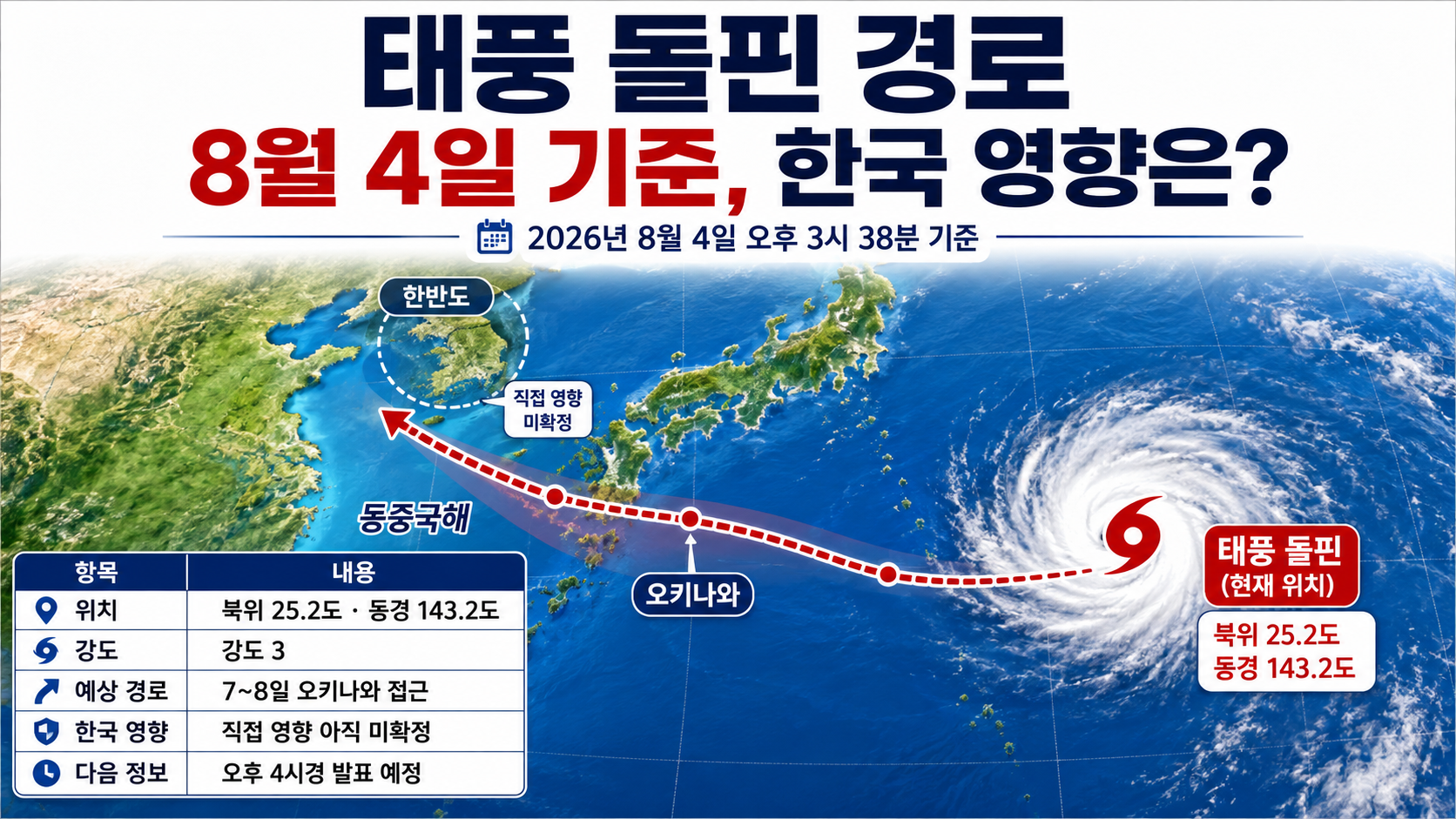
2026-08-04 As of 3:38 p.m., Typhoon Dolphin, the 13th typhoon, was moving westward at intensity level 3 over waters near latitude 25.2°N and longitude 143.2°E. It is forecast to pass near Okinawa on 7–8 before heading toward the East China Sea, but a direct impact on the Korean Peninsula has not yet been confirmed. The Korea Meteorological Administration is expected to release its next update at around 4 p.m.
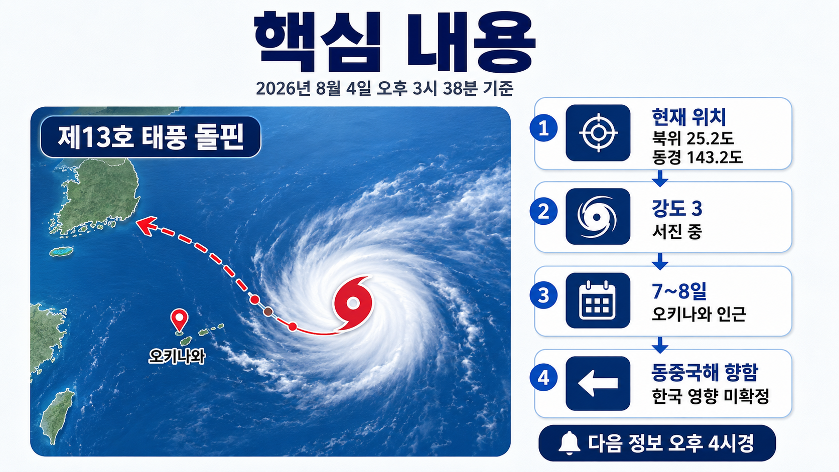
Where Is Typhoon Dolphin Now?
According to data released by the Korea Meteorological Administration (KMA) at 10 a.m. on August 4, Typhoon Dolphin's center was located at latitude 25.2°N and longitude 143.2°E as of 9 a.m.
Its central pressure was 950 hectopascals, and its maximum sustained wind speed near the center was 43m/s, or 155km/h. The typhoon was moving westward at 16km/h.
Its strong-wind radius was approximately 450km, although it extended about 350km in part of the southwestern sector. The storm-force wind radius, covering winds of at least 25m/s, was estimated at approximately 140km.
| Reference Time | Center Position | Central Pressure | Maximum Wind Speed | Movement Direction and Speed |
|---|---|---|---|---|
| Current as of August 4 at 09 | 25.2°N, 143.2°E | 950hPa | 43m/s | West at 16km/h |
| Forecast for August 5 at 09 | 25.4°N, 138.1°E | 950hPa | 43m/s | West at 20km/h |
| Forecast for August 6 at 09 | 25.9°N, 133.8°E | 950hPa | 43m/s | West at 21km/h |
| Forecast for August 7 at 09 | 26.5°N, 129.8°E | 950hPa | 43m/s | West at 17km/h |
| Forecast for August 8 at 09 | 26.8°N, 127.5°E | 955hPa | 40m/s | West at 9km/h |
| Forecast for August 9 at 09 | 27.5°N, 125.9°E | 960hPa | 39m/s | West-northwest at 7km/h |
If the typhoon follows its current forecast track, it is likely to approach waters east of Okinawa on 7 and pass through waters close to Okinawa's main island on 8.
However, the positions in the table are forecast center locations, not points through which the typhoon's center is guaranteed to pass.
Is It Still a Super Typhoon?
According to the KMA's assessment on August 4, Typhoon Dolphin was at intensity level 3. Since 2026, the KMA has classified typhoon intensity using numerical levels 1–5. Intensity level 3 corresponds to maximum wind speeds of at least 33m/s but below 44m/s.
At 9 a.m. on August 1, the typhoon was assessed at intensity level 4, with a central pressure of 920 hectopascals and maximum winds of 53m/s. By 9 a.m. on August 4, those figures had weakened to 950 hectopascals and 43m/s.
Author's Calculations
Maximum wind speed: 53m/s → 43m/s
Reduction: 10m/s
Percentage decrease: Approximately 18.9%
Central pressure: 920hPa → 950hPa
Change: An increase of 30hPa
Although Dolphin has weakened from its peak intensity, its strong-wind radius still extends approximately 450km. Okinawa and surrounding waters must therefore remain prepared for strong winds and high waves. A weakening typhoon does not mean the risk of damage has disappeared.
When Will Dolphin Come Closest to Okinawa?
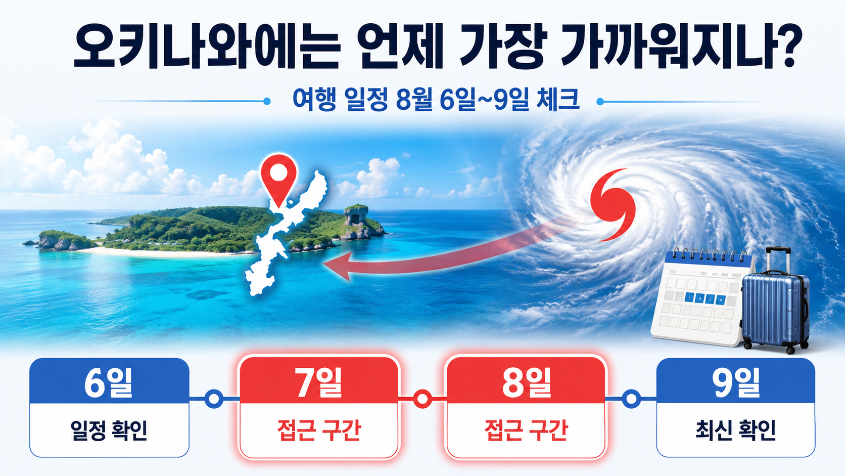
Under the KMA's current forecast track, the period from August 7 through 8 is when potential impacts on Okinawa require particularly close monitoring.
The forecast center position at 9 a.m. on 7 is latitude 26.5°N and longitude 129.8°E. At 9 a.m. on 8, it is forecast to be at latitude 26.8°N and longitude 127.5°E. This indicates a track passing through waters near Okinawa's main island from east to west.
However, whether the typhoon will make landfall in Okinawa, and exactly when it will make its closest approach, cannot yet be determined. Its forward speed is expected to slow to 9km/h on 8, which could also change the timing of its approach.
If you are planning to travel to Okinawa between August 6 and 9, it is advisable to check the following items.
Flight cancellation and delay notices from your airline
Flight operations information from Naha Airport
Typhoon-related cancellation policies for hotels and rental cars
Whether ferries and marine leisure activities are operating
Storm and high-wave warnings issued by the Japan Meteorological Agency
Travel insurance coverage conditions for flight delays
Rather than immediately canceling a trip based solely on the forecast track, decisions should be based on official announcements from airlines and local facilities.
Will South Korea and Jeju Island Be Directly Affected?
The KMA's forecast centerline published through 9 a.m. on August 9 did not indicate a landfall track across the Korean Peninsula. The typhoon is expected to move toward the East China Sea after passing Okinawa.
However, it is also too early to conclude that South Korea will experience no impacts. The 70% probability radius for the forecast position on August 9 expands to 440km. This reflects the increasing uncertainty surrounding the typhoon's center position as the forecast period extends.
The current assessment is as follows.
| Region | Current Assessment | What to Monitor |
|---|---|---|
| Jeju Island, land areas | Direct impact not confirmed | Whether the track shifts northward after 8 |
| Offshore waters south of Jeju | Potential indirect impacts require monitoring | High-wave advisories, rough seas, and the strong-wind radius |
| Southern coast | Direct impact not confirmed | Whether the typhoon moves northward and how atmospheric pressure patterns change |
| Inland areas | Typhoon-related rain and wind not confirmed | Changes in precipitation and wind direction in medium-range forecasts |
If the typhoon moves farther north than currently forecast, the possibility of wind and wave impacts could increase, beginning with the offshore waters south of Jeju. Conversely, if it continues moving westward, extreme heat and changes in wind direction may become more significant concerns than direct impacts on South Korea's land areas.
Will the Heat Wave End After Dolphin Passes?
Typhoon Dolphin alone cannot determine whether the heat wave will end. The direction of air flowing into South Korea depends on the typhoon's track and the position of the North Pacific High.
If the typhoon moves toward China over distant waters south of the Korean Peninsula, hot and humid air could flow into South Korea, prolonging the heat in western regions. If the typhoon's track shifts northward, the possibility of rain and wind would increase. However, neither scenario can be considered certain at this stage.
Alongside the typhoon's track, it is important to check regional medium-range forecasts, heat-wave advisories, and predicted maximum temperatures separately.
Why Do the KMA and Japan Meteorological Agency Report Different Figures?
Even for the same typhoon, national meteorological agencies may report slightly different estimates of central pressure and maximum wind speed.
As of 9 a.m. on August 4, the KMA assessed Dolphin's central pressure at 950 hectopascals and its maximum wind speed at 43m/s. At the same time, the Japan Meteorological Agency classified Dolphin as a very strong typhoon, estimating its central pressure at 945 hectopascals and maximum wind speed at 45m/s.
The differences between the two agencies' figures are as follows.
Difference in central pressure: 5hPa
Difference in maximum wind speed: 2m/s
These differences can arise from variations in the observational data used and the agencies' analytical methods. For safety decisions within South Korea, KMA announcements should take priority. For travel to Okinawa and local emergency responses, it is appropriate to also check warnings issued by the Japan Meteorological Agency and local authorities.
The 70% Probability Radius Is Not the Size of the Typhoon
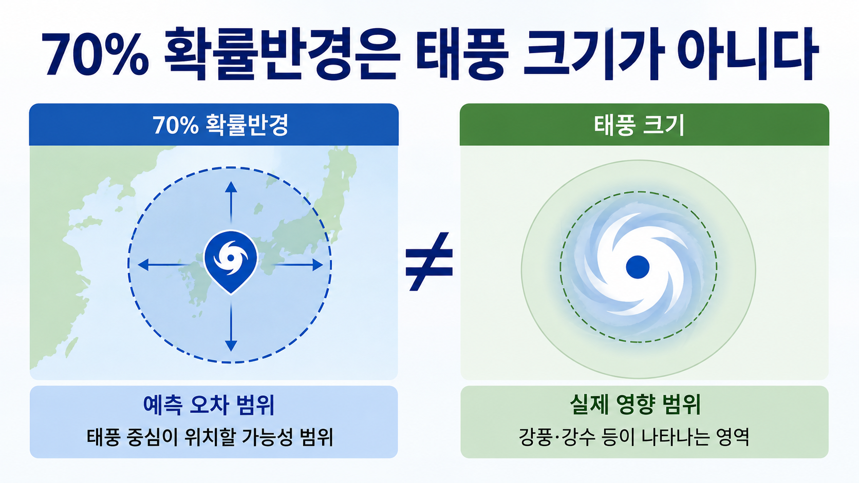
The 70% probability radius, often shown as a yellow circle or a broad area on forecast-track maps, does not represent the extent of the typhoon's strong winds.
The 70% probability radius indicates the area within which the typhoon's center may be located at a particular time. It also does not mean that the typhoon will follow the central forecast line exactly.
The distinctions are easier to understand when considered separately.
Forecast centerline: A line connecting the predicted center positions at successive forecast times
70% probability radius: The uncertainty associated with the forecast position of the typhoon's center
Strong-wind radius: The area experiencing winds of at least 15m/s
Storm-force wind radius: The area experiencing winds of at least 25m/s
The 70% probability radius is 190km on August 7, 290km on 8, and 440km on 9. The circles become larger for later forecast dates not because the typhoon itself is growing, but because uncertainty in its predicted track increases over time.
The Next Official Update to Check
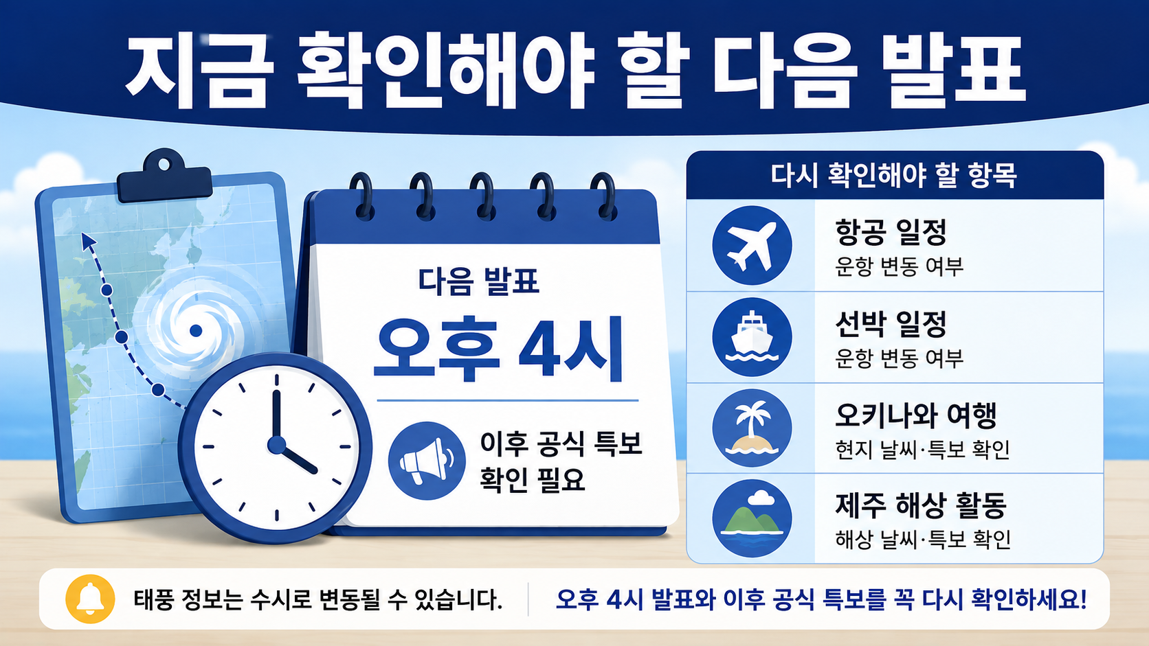
The information in this article is based on the KMA typhoon bulletin issued at 10 a.m. on August 4. The KMA announced that its next update was scheduled for approximately 4 p.m. on August 4.
The following four points should be compared when the new bulletin is released.
1. Whether the forecast center positions for 7–8 have shifted northward or southward
2. Whether the predicted time of passage near Okinawa has moved earlier or later
3. Whether maximum wind speeds and the strong-wind radius have decreased
4. Whether the track after 9 points toward China or toward offshore waters south of Jeju
A typhoon's forecast track is not something to check just once. Anyone planning travel to Okinawa, marine activities near Jeju, or flights and ferry journeys should review the update scheduled for 4 p.m. and subsequent official weather advisories.
---